

So, you’ve decided that a high-resolution 3D assessment of your site would help clear up the uncertainty in where any residual product is hiding and what its spatial relationship is to the soil permeability and the installed monitoring and recovery wells. How do you get started?
Multiple organizations including U.S. EPA (www.epa.gov/ust), ASTM International (astm.org), the Interstate Training and Regulatory Council (ITRC.org), the American Petroleum Institute (API.org), the Australian Cooperative Research Centre for Contamination Assessment and Remediation of the Environment (CRCCare.com), and the individual state jurisdictions all have published guidelines for undertaking a systematic assessment of petroleum contaminated sites.
Turns out, you probably have a lot of important information readily available to get started. Your key to success going forward will be both a systematic review of where your current LCSM stands to identify data gaps and uncertainties followed by a systematic data collection effort to close those data gaps with multiple lines of evidence.
Step 1: Conduct a desktop review of the current LCSM including:
- Type and age of residual petroleum contamination, physical and chemical properties.
- Identification of likely residual product based on observed product, soil contamination concentrations, and groundwater contaminant concentrations.
- Location, depth, and screen interval of installed monitoring and recovery wells.
- Hydrogeological conditions.
- Boring logs for soil descriptions.
- Existing site structures.
- Potential receptors.
Step 2: Identify the project business and technical objectives. Careful assessment of all pertinent goals at this point is important. Does your primary concern involve a decision on the best remediation alternative or optimizing the system currently in use? Are there other technical goals such as evaluation of offsite migration or vapor intrusion to nearby structures? What time and budget constraints exist? Are there legal or regulator elements to consider?
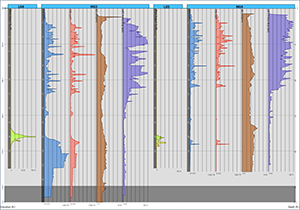
Step 3: Visualize the current conceptual site model. Where are the known petroleum impacts in relation to the soil stratigraphy and installed monitoring and recovery wells? What structures might be affected?

Step 4: Develop the lines of evidence needed to close the data gaps between the current state and the desired project endpoint as defined by the business and technical objectives.
Step 5: Identify the best options for collecting the scale-appropriate data needed to complete the desired lines of evidence. This process will evaluate what technologies are best suited for the physical and chemical properties of the residual petroleum, measuring the hydrogeological conditions, the drilling conditions, and any site access issues.
Step 6: Conduct the field data collection systematically building the desired lines of evidence to:
- Identify the residual petroleum,
- Measure the soil permeability,
- Evaluate the transmissivity of the residual petroleum,
- Evaluate the effectiveness of ongoing remediation efforts including natural source zone depletion (NSZD),
- Monitor for potential vapor intrusion.
Step 7: Update the LNAPL Conceptual Site Model to provide a view of the spatial relationship of the residual petroleum, the soil stratigraphy, the hydrogeological conditions, the installed monitoring and recovery systems,
Successful completion of these seven steps should provide you and your evaluation team with the critical elements necessary to estimate the residual petroleum volume and mass, identify probably storage and transport pathways, estimate the amount of mass still moving or mobile, identify potential vapor intrusion entry points, and decide on cost-effective remedial alternatives.
Follow this blog as we walk through the elements of high-resolution site characterization, what works, what doesn’t work, and learn how to achieve better results earlier and at lower cost on your leaking underground storage tank (UST) site.
In the meantime, please call or email us if you have specific question regarding this systematic approach, your site conceptual site model, or possible technologies to consider for your site assessment.

Other Blog Posts that may be of interest:
6 Reasons for High-Resolution Characterization of Your UST Site
5 Steps to Developing Weighted Lines of Evidence During Site Characterization
Revised Characterization Plan Accelerates Petroleum Brownfields Cleanup and Redevelopment
